Petra's Water System
How the Nabataeans tamed desert floods. Channels carved into canyon walls, hidden cisterns and a flood-diverting tunnel: how the Nabataeans turned rare desert rain into a thriving city.
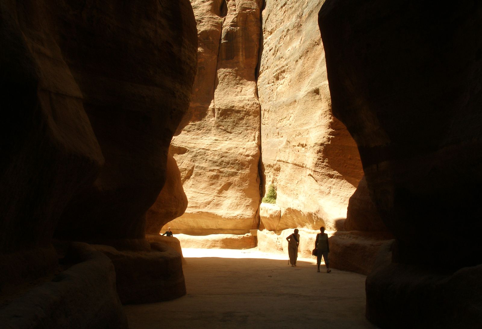
The Siq, the winding canyon entrance to Petra: Vyacheslav Argenberg, CC BY 4.0
A city built on scarce water
Petra is famous for the rose-colored tombs and temples carved straight into its cliffs, but the real secret of the city lies in the stone at your feet. Petra sits in a dry, rocky landscape that gets only a little rain each year, most of it in winter storms. Yet at its height in the first century CE the Nabataean capital supported an estimated 20,000 people, along with gardens, baths and fountains.
The Nabataeans, an Arab people who grew rich on the incense caravan trade, made that possible by treating every drop as treasure. Archaeologists now see their water network, as much as the famous facades, as the key to the city's rise.
Channels along the Siq
Most visitors still enter Petra the ancient way, through the Siq, a winding natural split in the sandstone whose walls rise between about 91 and 182 meters and narrow in places to just 3 or 4 meters. Look closely at the base of those walls and you will see long grooves cut into the rock. These channels carried spring water from Ain Musa, about 7 kilometers east, into the heart of the city, and some once held clay pipes.
The engineers kept the slope steady so water flowed smoothly by gravity, and they added small basins along the way where sand and grit could settle out before the water reached homes and public fountains.
Taming the flash flood
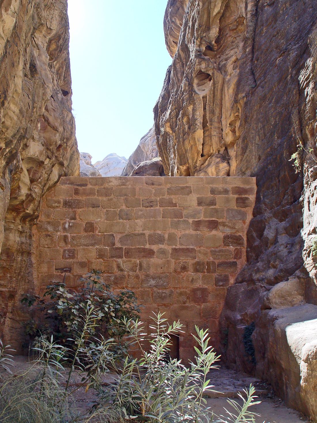
The bigger danger was too much water at once. Winter storms can send sudden flash floods down Wadi Musa, and the Siq is a natural funnel. Between the first century BCE and the early first century CE the Nabataeans built a dam across the mouth of the Siq and cut a tunnel, roughly 80 meters long, through the mountain to steer floodwater into a neighboring valley instead. The dam at the entrance today is a modern rebuild, from 1963 and again 1991, closely based on the original.
Smaller dams in side gorges slowed runoff, and rock-cut channels on the slopes caught rain and led it into cisterns. Many cisterns were bottle-shaped, with narrow openings that kept water cool, clean and easy to cover.
Water as a show of wealth
In the center of the city, archaeologists uncovered a garden and pool complex from the reign of King Aretas IV. Its pool measured about 43 by 23 meters and 2.5 meters deep, holding more than 2,000 cubic meters of water, with an island pavilion in the middle. In the heart of a desert, that was a dazzling statement.
After a major earthquake in 363 CE damaged the water system, the city slowly faded. Today Petra is a UNESCO World Heritage Site, listed in 1985, and its carved channels still show how careful planning can turn rare rain into a living city.
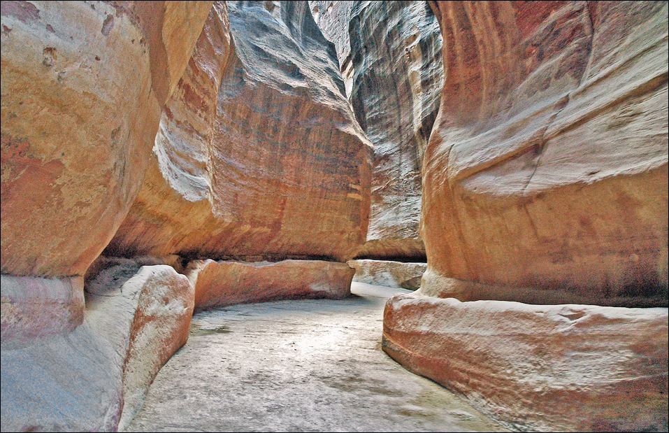
- The Siq, the winding canyon entrance to Petra: Vyacheslav Argenberg, CC BY 4.0
- Water channels cut along both sides of the Siq: Le Médocain, CC BY-SA 4.0
- A Nabataean-style dam in the Siq area of Petra: Etan J. Tal, CC BY 3.0
Text written by Ancient Visionary.
← Roman Aqueducts: Rivers on ArchesEratosthenes Measures the Earth →